私のお気に入りのアプリ
素晴らしいアプリ、使いやすい。中小企業がさまざまなマーケティング資料を専門的に作成するための時間と費用を節約できるようになります。ありがとう。
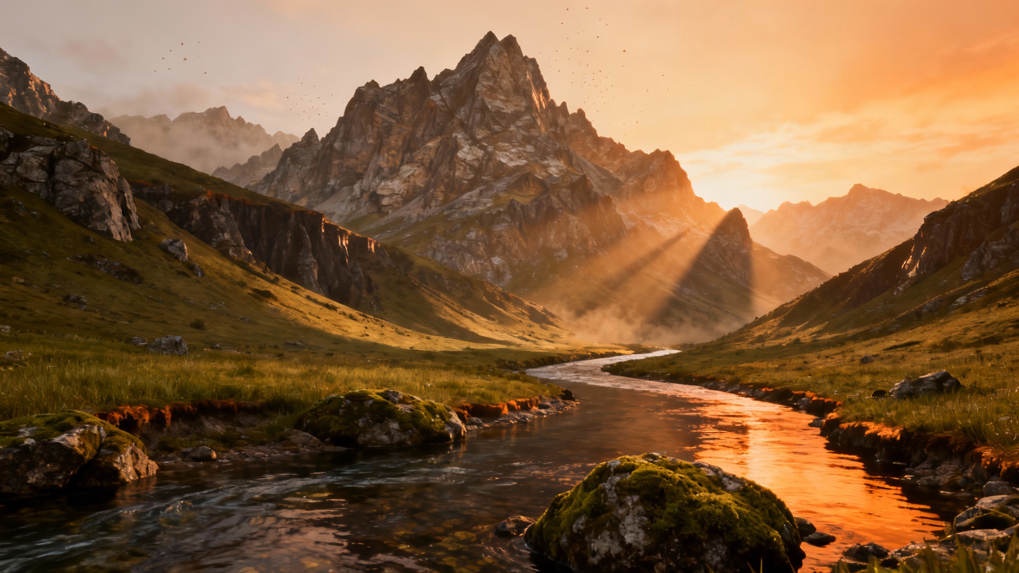
Start by typing a detailed description of the terrain you want to create. Include features like 'craggy mountains,' 'winding river,' or 'sandy dunes.'
Click the generate button and our AI will interpret your text, creating a detailed grayscale height map based on your description in just a few seconds.
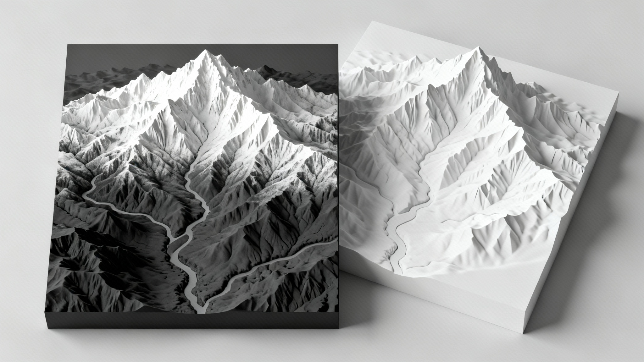
Download your high-resolution PNG height map. You can then import it into your favorite game engine or 3D modeling software to create your 3D world.
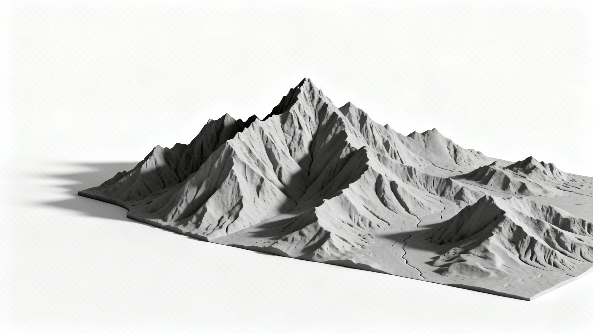
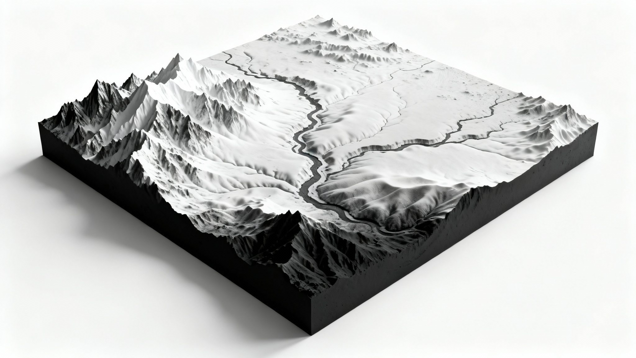
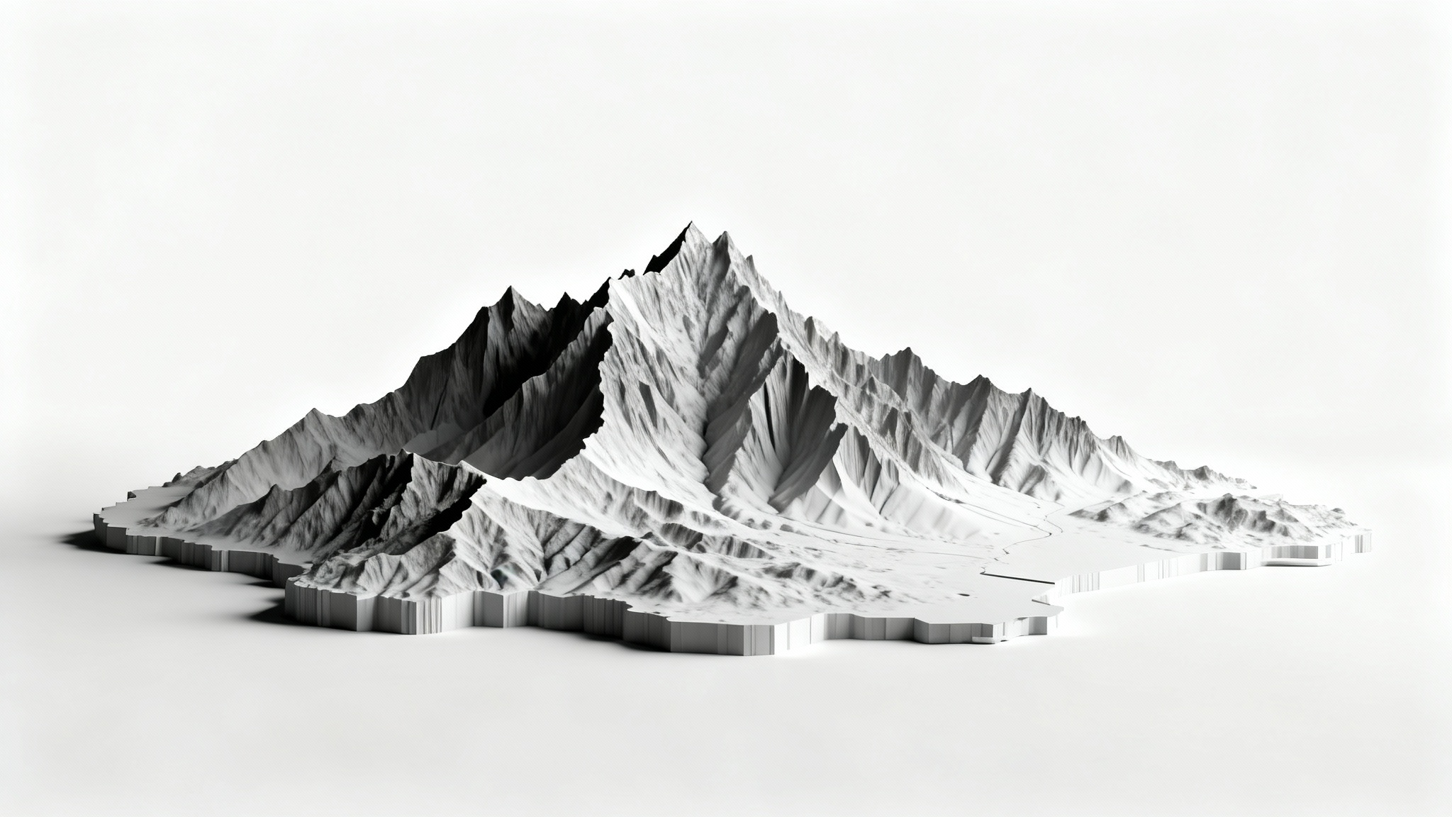
An AI height map generator is a tool that uses artificial intelligence to create a grayscale image representing terrain from a text description. You describe the landscape features you want, such as mountains, valleys, or plains, and the AI generates a map where shades of gray correspond to different elevations.
A height map is typically used as a displacement map in 3D software or game engines. You can import the PNG file into programs like Blender, Unity, or Unreal Engine to displace a mesh and create a 3D terrain model that matches the elevation data from the map.
A good prompt is descriptive and specific. Instead of just 'mountains,' try 'a jagged mountain range with sharp, eroded peaks and a wide, U-shaped glacial valley.' Mentioning specific features, textures, and the relationships between them will give the AI more information to create a detailed and accurate map.
While the AI generates new, original landscapes based on your descriptions, you can guide it by describing a real-world location. For example, you could describe the features of the Grand Canyon or the Swiss Alps to generate a terrain that is inspired by that location. For more direct real-world data, other specialized GIS tools are available.
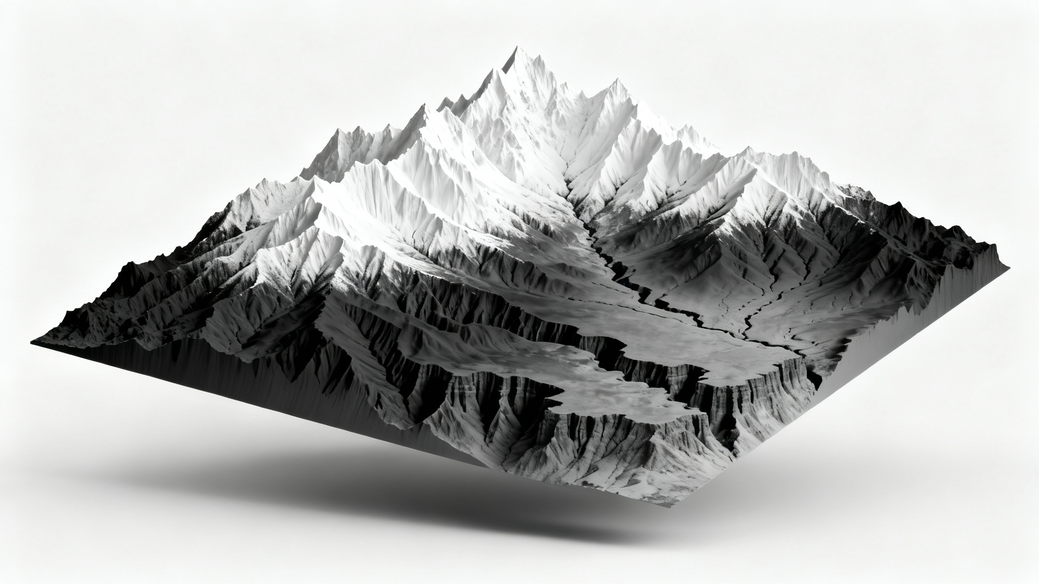
A height map displaces the actual geometry of a 3D model, changing its physical shape based on elevation data. A normal map simulates the appearance of detail and texture by changing how light reflects off a surface, without altering the underlying geometry. Height maps create real depth, while normal maps create the illusion of depth.
Your height map will be downloaded as a high-resolution, watermark-free PNG file. This format is widely compatible with most 3D modeling software and game engines.
素晴らしいアプリ、使いやすい。中小企業がさまざまなマーケティング資料を専門的に作成するための時間と費用を節約できるようになります。ありがとう。
私の仕事には優れた背景除去剤が必要で、私はそれをすべて経験してきました。これは今のところ最高です。使い方はとても簡単で、結果は常に素晴らしいものになります。ピクセルカットさん、ありがとうございます!
驚くほど簡単で、バッグやアクセサリーに完璧な結果が得られます。プロのカメラマンが撮影したようです。